
The changing face of the Mono Basin aqueduct

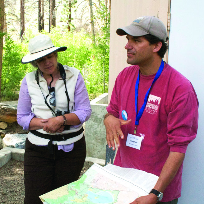
Mono Lake Committee (MLC) Information and Restoration Specialist Greg Reis has been leading tours of the Los Angeles Department of Water and Power (LADWP) aqueduct in the Mono Basin for 15 years. On June 20, he took Mono Basin Bird Chautauqua participants from the aqueduct’s highest northern point at Lee Vining Creek along the aqueduct, passing tributary streams, Grant Lake Reservoir, and ending at the West Portal, where the aqueduct passes under the Inyo Craters, crossing 11 miles to meet up with the Upper Owens River.
The aqueduct was built 40 years ago.
While the LADWP built the aqueduct to export water, it is now adapting to return some of that water to Mono Basin watersheds. That effort began at Rush and Lee Vining Creeks in the 1990’s, but has increased significantly after the 2013 Settlement Agreement to restore Rush, Lee Vining, Parker, and Walker Creeks.
The Agreement, in which Reis played a pivotal role, was the result of three years of effort between the Mono Lake Committee, LADWP, California Department of Fish and Wildlife, and CalTrout. The Agreement will restore 19 miles of Mono Basin streams without any reduction to water exports to Los Angeles.
The first stop on the Reis’ tour was at an LADWP flume on Lee Vining Creek. Flumes above and below water diversion points are used to measure how much water is going in and out of the aqueduct system.
Water from Lee Vining Creek flows over the flume and into a diversion dam, which forms a pond. Reis explained the challenge the LADWP used to face in excavating built-up sediment from the pond. The LADWP would dredge sediment from the pond and dump it elsewhere on dry land.
Unfortunately, “that sediment is really important for the ecosystem downstream,” he said.
Without a dam blocking the movement of sediment, typically high flows during flooding events would carry sediment through the watershed, benefiting plants and animals.
To solve this problem, the LADWP installed a gate in 2005 that allows the LADWP to drain the pond, including sediment, downstream to mimic peak flows.
Under the new Settlement Agreement, the LADWP will allow these flows downstream anytime the flow exceeds 250 cubic feet per second. For comparison, the stream was flowing at only 31.9 cfs on Saturday.
Reis said this is just one of many management techniques outlined in the Settlement Agreement, which is currently going through an engineering and environmental analysis before it returns to the State Water Board for final approval.
“Hopefully that will be done this fall, so we can start implementing [these techniques],” Reis said.
From Lee Vining Creek, the tour followed the underground aqueduct, which rests on top of a Mono Lake terrace carved about 140,000 years ago during the Ice Age. As in the Owens Valley, the Mono Basin aqueduct is entirely gravity fed.
The aqueduct crosses Walker and Parker Creeks as they flow from high canyons above the June Lake Loop, into Grant Lake, which used to feed Rush Creek.
Reis explained that Rush Creek qualified for restoration work after high flows introduced trout to the Creek in 1983. A group called Mammoth Fly Rodders (MFR) found fish in the Creek, and protested the LADWP’s proposal to eliminate flows below the aqueduct diversion in 1984. MFR discovered that per a California Fish and Game code, dam keepers must keep fish below dams in good condition.
“The County sent Sheriff’s Deputies out to stop the LADWP from turning off Rush Creek,” Reis said.
The LADWP capitulated, and began diverting minimum flows into Rush Creek. The same happened at Lee Vining Creek.
Although many changes in LADWP management to restore fisheries and revive creek habitat came as the result of judge orders into the 1990’s, Reis said that changed in 1995, when the Mono Basin experienced a runoff year 200 percent of average. Up until that point, stream restoration work required using machinery to excavate dry creek beds, and much more hands-on work from the LADWP to maintain flows.
“We and the LADWP saw what a benefit that [runoff] had for fish habitat work,” Reis said. “The philosophy shifted [after that] to a more hands-off approach … Natural flows are more sustainable in the long term.” Reis said the LADWP has been on board with restoration work since then.
One of the final stops on the tour was the Grant Lake Reservoir, which dropped dramatically over the past four years of drought, and after LADWP exported its full water allotment in April of this year.
Reis explained that Grant used to be a natural lake, smaller and rounder than the current lake, with wetlands and aspen meadows. Lake water fed directly into Rush Creek, which is the creek most impacted by LADWP diversion.
“Unfortunately, when the LADWP put a dam in [Grant Lake], it did not put an outlet in it directly to the Creek,” Reis said.
Instead, the outlet valve is across from the lake spillway, and water traveling through it bypasses Rush Creek for about a mile.
“The solution in the Settlement is to build a new outlet,” Reis explained. The LADWP will also build a lower spillway with gates, allowing the LADWP to keep the lake level at Grant lower and still export water from it into the aqueduct.
The cost of improvements to Grant Lake infrastructure is about $15 million. This raised the question from one tour participant: What does the LADWP get out of all of these changes?
“They don’t want to do any of this,” Reis said; “They don’t want to spend money they don’t have to.” That said, the Settlement Agreement created an opportunity to provide assistance to the LADWP. For one time only, the LADWP will export an additional 12,000 acre-feet from the Mono Basin, the value of which will cover about 50 percent of the cost of improvements.
The final stop on the tour was at West Portal, where the aqueduct continues as an 11-mile tunnel to the Upper Owens River. From there, it flows to Crowley, and from there, through the Owens Valley.
Reis noted that the West Portal tunnel construction created a boomtown from 1934 to about 1940, complete with a hospital and about 400 residents.
Looking around at old and new aqueduct infrastructure, one tour participant wondered whether the LADWP would ever leave the area.
“Mono Basin water is the highest quality of any of their sources,” Reis said. “… They’re always going to want it.”
He pointed out that the water is also used to run the Owens River Gorge hydroelectric plant, and that even if the LADWP were to stop using Mono Basin water, it would still be responsible for maintaining all of the dams and infrastructure in the area—or shoulder the cost of removing them.


