
The trees tell a tale of historic drought
We all know the drought in California is bad. Sure, the Eastside has seen a couple of summer showers and a little snow, but it’s getting medieval, literally. It’s the driest its been on the Eastside for as long as people have been keeping records. But if you ask the trees, the 2012-2015 drought is the most severe the state has seen in at least 500 years and maybe the worst in 3,100 years.
Local records of area surface water list this year as the driest ever. A study conducted Sept. 12 at Big Springs, the headwaters of the Owens River measured flow at 17 cubic feet per second (cfs) far below the average of 36 cfs. The California Department of Water Resources records dating to 1950 has 2015 as the lowest spot on the chart, only 6 percent of average. The conclusions of a new study published in the journal, Nature, are that the Golden State is experiencing the driest weather in at least 500 years.
The study in Nature was a combination of two different tree-ring studies. The study looked at tree-rings of a native and prolific California species, the blue oak which, “reflect large-scale California winter precipitation anomalies,” along with tree-ring based temperature models to reconstruct snowpack, or “snow water” records over the past 500 years.
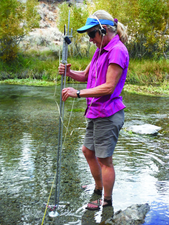
Sue Burak.
This year’s diminished snow pack coincides with record high-temperatures for the state, according to the study. It concludes that “anthropogenic warming” or climate-change caused by humans is likely to increase the chances of extreme weather including droughts and faster snowmelt.
A geophysics study of soil moisture and tree-rings conducted by Daniel Griffin and Kevin J. Anchukaitis and published in Geophysics Research Letters in 2014 concluded that the period between 2012-2014 was the driest in the state in 1,200 years. But the 2015 study is the first to break down the weather year-by-year.
Additional research cited in the 2015 study concludes that the current drought exceeds any in the state in 3,100 years, but that research has a large margin of error.
Burak’s Local Study
Just past the Crestview Rest Area off Highway 395 is an area lush and green with water bubbling out of the ground surrounded by basalt rock lava flows. There are hundreds of springs in a small stretch of river channel that eventually becomes the Owens River, hence the name Big Springs. The water channel is nearly dry before the, “Gusher” a 15-foot long wall sprouting water.
The spring has been measured by the United States Geological Survey since the 1980s. Hydrologist Sue Burak started measuring the flow with the USGS in 2008 and used part of the research for her master’s thesis. She continues to measure the flow for her own curiosity and “because its so interesting,” she said wading in the ankle deep water taking measurements.
To measure the flow of the river, Burak first stretches a measuring tape across the river and at the same spot she and the USGS before her have been taking measurements. At each one foot interval across the river, she measures the depth of the water with a wading rod, a long metal tube. At the end of the tube is what looks like a two-inch diameter pygmy boat propeller.
The pygmy is hooked to wires and batteries then to headphones Burak wears. The water pushes the propeller around with each revolution of the pygmy producing a clicking sound sent to Burak’s headphones. She counts every click for a minute and uses a chart to translate the clicks into water flow.
The flow on Sept. 12 was 14 cfs, as dry as she’s ever seen it.
Burak said the measurements will become useful to a future study “to identify the amount of groundwater there is when there become even more competing demands.”


