
New state tree survey offers grim projections
“Your side’s the better side for sure,” Carnegie Institute of Science ecologist Greg Asner told The Sheet in an interview last month. He was speaking of the drought’s affect on California’s forests, which is pronounced on the west side of the Sierra; somewhat less so on the east side.
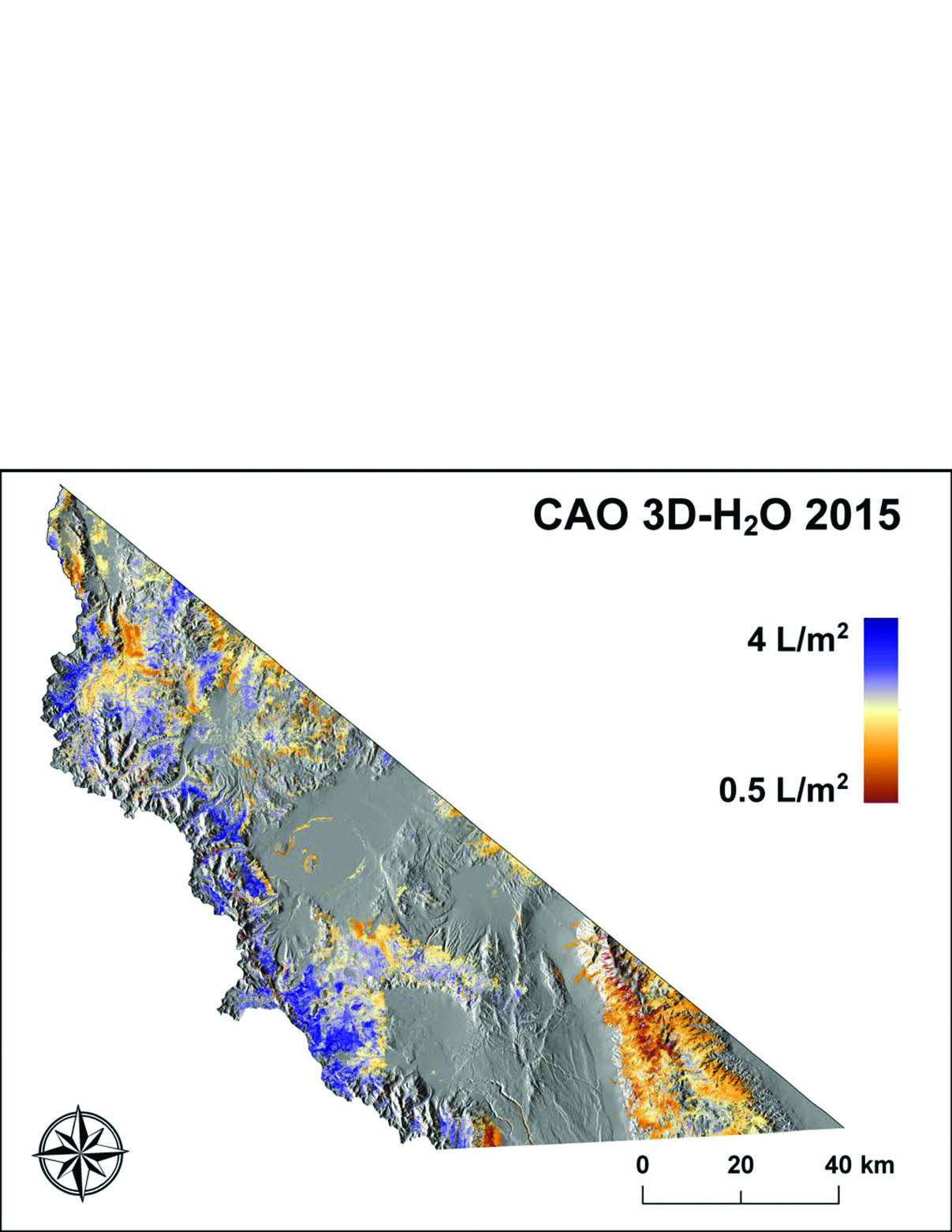
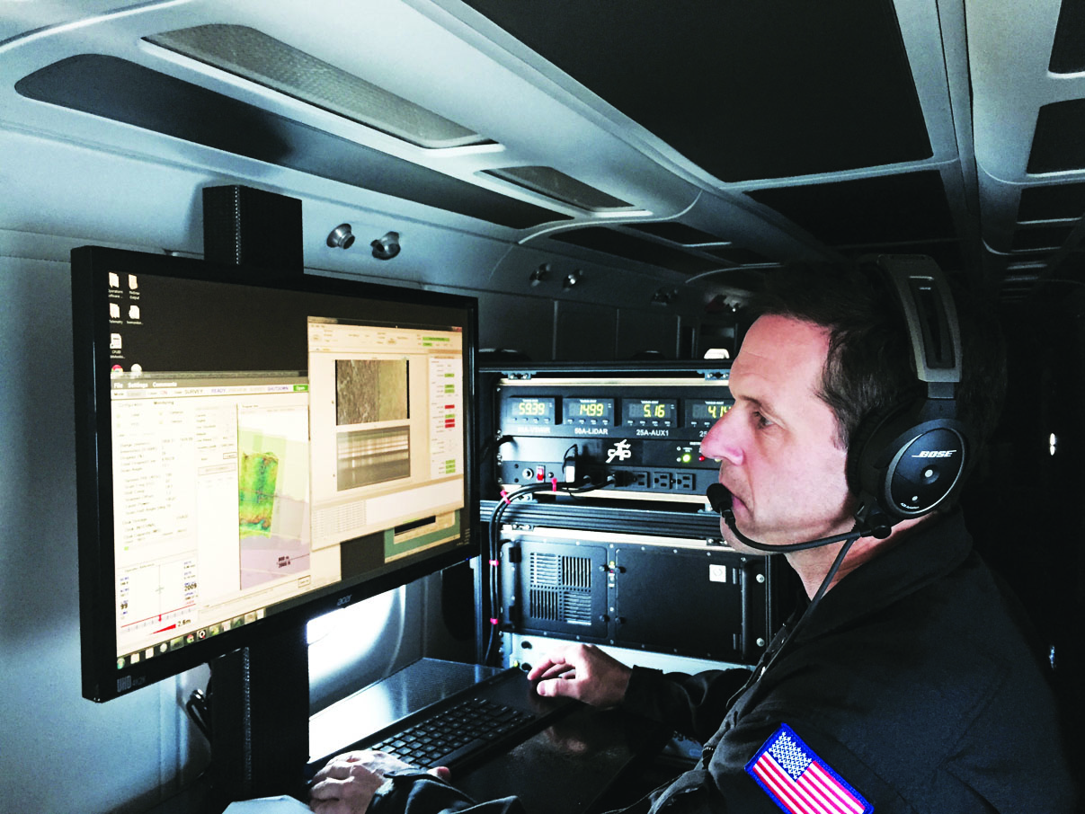
Asner recently released the results of an airborne survey of the state’s forests conducted over this past summer. Asner used a spectrometer aboard a twin turboprop to measure the amount of water in the foliage of trees. This allowed Asner to see not just which trees have already died, but which trees are stressed.
“Trees have changed their water content a lot by the time you notice with the naked eye,” he explained. “We’re trying to use spectrometer for more predictive capability… kind of like going to the doctor and getting a blood test.”
The U.S. Forest Service (USFS) conducts annual aerial tree surveys by flying low to the ground (usually at about 1,000 feet), using two observers to count brown trees and extrapolate the total number of dead trees within a larger area. Using this method, this year the USFS counted about 21 million dead trees statewide, with 12.5 million of those trees in the southern Sierra, the majority on the west side.
But Asner’s study upped the likely number of dead trees to as many as 120 million within the next few years. That’s because his study revealed that 7-20 percent of the state’s adult trees are stressed enough that they could soon succumb to drought, regardless of this year’s El Niño precipitation.
Asner did caution that his study does not include juvenile trees hidden underneath the adult tree canopy. But the death of up to 20 percent of a USFS- estimated billion-plus trees could have devastating consequences.
“We don’t know how much of the forest that we’re mapping is committed to death,” Asner said. “We’re not going to know for sure until we re-fly next year.”
Large trees will take about two to four years to succumb to drought-induced stress, he said.
When it comes to the effects of drought, both the kind of tree, and the tree’s elevation, make a difference.
“Lower forests [3,000 to 6,000 feet in elevation] are not doing well,” he said. “As [trees] get higher, the impact is very species-specific. For example, sugar pine in the southern Sierra is doing poorly, whereas the firs are not as troubled right now. But you see certain species that are showing the worst condition, relative to the rest, like a lot of pines are doing really poorly.”
USFS ecologist Marc Meyer said that “We’re seeing different signs of stress in different species in the Inyo [National Forest], but we’ve been lucky so far that we haven’t had such a dramatic impact here as on the west side.”
Trees living closest to the snowpack appear to have escaped much of the stress and death of lower-elevation forests. However, Asner speculated, “Maybe they’re on a short-term subsidy … If we don’t get snowpack, then I wonder if that subsidy will eventually dry out, and we’ll start to see more mortality up high.”
While Asner’s study results came as a shock to many, he emphasized that knowing the percentage of stressed trees, and which areas in the state are particularly stressed, “means we can focus on extra monitoring and management on those areas. That’s the key. If we don’t have that, then we don’t have any idea what’s happening, and we just wait for it to happen.”
Asner said that both federal and state agencies are using his findings, which include 3-D topographic maps created using spectrometer and laser data, to consider thinning, fire breaks, and prescribed burn projects across the state.
USFS Public Affiars Officer Deb Schweizer noted that the USFS has already ramped up its local thinning projects around areas like June and Mammoth Lakes. “This past year, we’ve done about 1,000 acres of thinning, where there have been years when we only did 200 to 300 acres,” she said.
Thinning not only reduces fuel for wildfire, but allows remaining trees more access to moisture, which in turn helps protect against beetles.
But couple drought with climate change, and management strategies may become still more complex.
“As the climate warms, the prediction is that species will move upward”—given that the animals that traditionally move seeds will move upward—“if and only if there’s enough space and moisture for that,” Asner said.
“One long-term mitigation approach that everybody needs to get serious about is making sure there are corridors and enough protected areas that allow species to move and migrate, because they do; they absolutely do move with climate change. My colleagues have been measuring the actual movement of species up the mountains in the Andes.”
Asner said that mountain systems like the Andes and the Sierra “are where we hope there will be climate refuge. Places where trees could migrate and survive.”
But Meyer noted that many trees may simply not weather the change in climate. “We’re looking at significant mortality with the current drought, but when you put that on top of regional warming trends, what it results in is unprecedented tree mortality, especially in the Southern Sierra,” he said.
This means an elevated risk of erosion, which could impact watersheds, as well as increased fire danger.
Meyer noted that even if some trees do migrate, others may not be able to survive the change. “For example, it will take ponderosas decades to establish themselves and become reproductively mature at higher elevations,” he said. “Some trees may therefore shrink in distribution; some may be in trouble.”


